|
Earthwork Survey |
|||
|
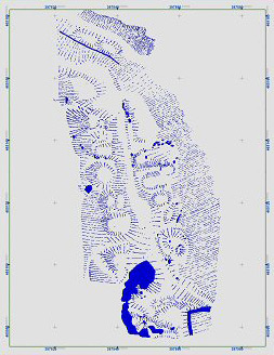
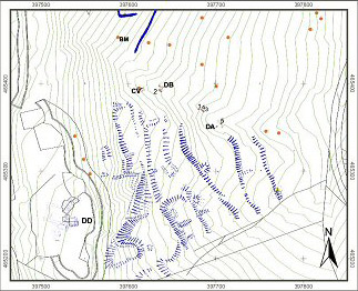
The complex earthworks in the study area were first described by Dr Arthur Raistrick in the 1960s. They have been mapped from aerial photographs, but until our project started there has been no detailed record or investigation on the ground. |
|||
|
On the level terrace above the field systems, Dr Raistrick identified a Romano-British hut circle and enclosures. The current project has carried out more detailed surveys that give a better idea of the complexity of the surviving evidence. |
|||
 |